Mt. Binacayan Hike with Merrell Philippines, Trail Adventours
The tale of Bernardo Carpio, a man of great strength who was trapped between two huge rocks, is one of the most interesting myths in the country. But, did you know that the two mountains described in the story are believed to be Mt. Pamitinan and Mt. Binacayan in Rodriguez (formerly Montalban) in the province of Rizal? Merrell Philippines and Trail Adventours hosted a weekday hike last June 6 to encourage more people to try the outdoor lifestyle.
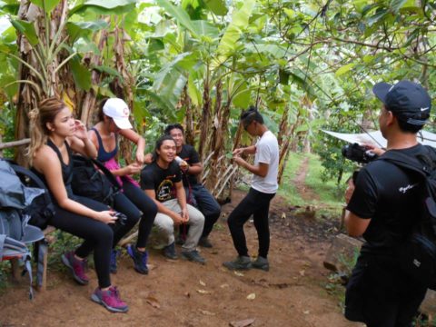
It was a Tuesday morning when we climbed Mt. Binacayan, which stands at 424 meters above sea level (MASL). Between the two mountains is the infamous Wawa Dam which provides water to residents of Metro Manila. The group of was composed mainly of bloggers and influencers accompanied by James de Castro of Merrell PH and Coby Sarreal, one of the founders of Trail Adventours.
(Video Credit: Erika X John, Youtube)
From our meeting point in Ortigas, the group traveled roughly an hour before reaching Barangay Wawa in Rodriguez. It was a chilly morning because it has rained the afternoon before the climb. After paying the environmental fee and registering in the barangay, we sought the services of our guide Kuya Roland.
Conquering Mt. Binacayan with Merrell’s New Line of Hiking Shoes
James then briefed us shortly about the climb and its purpose. Merrell has been doing a series of hikes (the week before they did Mt. Pundaquit via Anawangin) to introduce some of their latest hiking shoes- the Merrell Moab 2 for men and the Merrell Siren for women. Both are excellent for climbing and are waterproof thanks to its Goretex technology.


We started the day hike at around 6:00 A.M after a few minutes of stretching. The first part of the trail led to the base of the mountain where a few of the residents live. It was a calm morning where we traded “good mornings” with the locals we met along the way. Less than 200-meters after our starting point we hit the slightly muddy part of the trail.
Limestones & Technical Ascent
The first quarter of our hike to the summit was composed mainly of single track trails surrounded by vegetation and some overgrown roots. We also passed by several shacks that sell food and refreshments. There was a lot of chatter among the group as it was a mix of first timers and experienced hikers. The newbies were very curious, while the veterans in the group were keen to share their stories and some tips in climbing.
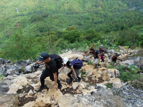
Past the forestry patch of the trail was the technical part of the climb. From here on we have to climb through sharp limestone formations and overhung tree branches. Kuya Roland was very helpful in showing us the “diskarte” on tackling the difficult parts of the climb. He also mentioned that there are times that the mountain is surrounded by a lot of monkeys who scour for food.
Witnessing the Sea of Clouds Atop Mt. Binacayan
After an hour or so, we reached the first clearing which treated us with a great view of a sea of clouds. The group rested for a while just to take some videos and pictures, all the while eating the trail food that we brought. (Thanks to James for carrying the group’s food!) After some chat, mostly about blogging, life experiences and haughty laughs we proceeded to the next clearing.
![]()
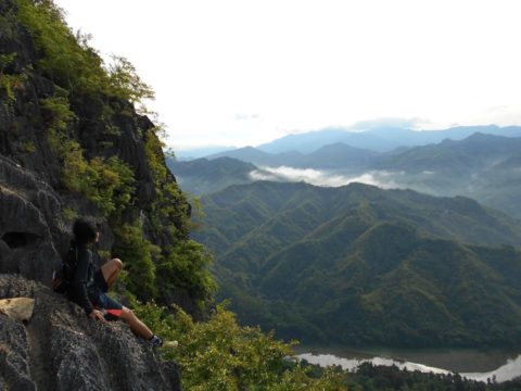
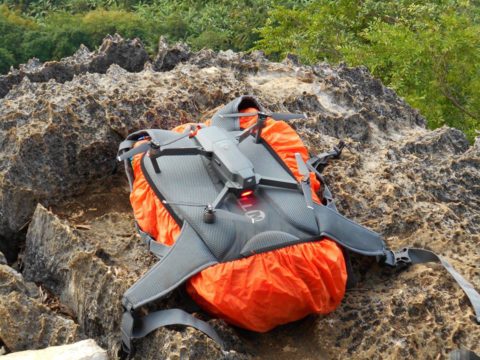
It took us around 15 minutes to reach a rocky a cliff with a small monolith and a gorgeous view overlooking Wawa River and the nearby mountains. John Manalo took the opportunity to video the place using his lightweight drone which he carried on his backpack. Technology never fails to amaze me!
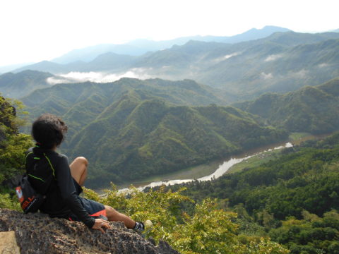
We’ve spent the longest time in this spot. The mountain was very tranquil at that point. I believe we were the only ones who climbed the mountain that day. We were also quite lucky that it did not rain, but there were occasional clouds to make the weather just right. The group decided to head for the summit after about a couple of hours on that cliff.
View from the Summit
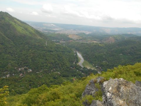
We reached the summit at around 10:30 A.M. The peak has a good view of the Sierra Madre range, and the nearby town of San Mateo. You can also see the entirety of Mt. Pamitinan from here.
If you are seeking for more challenge, you can do a trilogy by adding Mt. Hapunang Banoi (517 MASL).also do a twin hike of Mt. Binacayan and Mt. Pamitinan (426 MASL) which could take an average of 4 to 6 hours.

(Photo Credit: John Lherry de Guzman)
The Steep Descent
At past 11 a.m., the group decided to climb down. We took a “shortcut” route which was a very technical descent with boulder-sized rocks, edgy limestones and narrow gaps in between. Before noon we were at one of the stores near the base of the mountain and bought beverages and mineral water. The mango juice and blended avocado were very refreshing.
After a short stay, the group then went back to Barangay Wawa’s center. We then headed to one of the nearby eateries to have our lunch and later get a bath and a change of clothes. To cap the day off, we visited the Wawa Dam. It was already around 3:00 p.m. when we left Rodriguez and drove to the metro.
Overall, the trip was one of the best ones I had for some time now. It was a perfect combination of good weather, great company, and just taking a break and being with nature. Conquering Mt. Binacayan went on smoothly thanks to my pair of Merrell Agility Peak Flex which performed well to propel me on the trail’s rocky and muddy terrain.
For more photos click here -> TAKBO.PH’s Mt. Binacayan Hike Album
About The Author
Adrian John Ladaga
Adrian started running in 2012 and instantly fell in love with the sport. He now frequents local running events. For him running is simple "you take one foot in front of another and repeat the process over and over again." You can catch him running in CCP and the Quirino Grandstand. When not on his running kicks, he steps in the shoes of a content writer and Search Engine Optimization (SEO) expert.